IMMERSIVE LEARNING PROJECT WITH THE URBAN LIGHT COMMUNITY DEVELOPMENT CORPORATION
Project Background
The Industry Neighborhood Action Plan seeks to identify a myriad of community concerns, from aged infrastructure to blighted housing concerns, and compile this information in a comprehensive planning document. With the extensive data collection process required, I led our studio's adoption and implementation of ArcGIS Collector, a field application that captures pictures and uploads data to the cloud real-time. As the project’s GIS lead, I was tasked with visualizing collected field data into a series of map frames. With this informed data analysis, a series of recommendations were made to assist the community with grassroots economic growth, housing security, and governmental cooperation.
The Industry Neighborhood Action Plan seeks to identify a myriad of community concerns, from aged infrastructure to blighted housing concerns, and compile this information in a comprehensive planning document. With the extensive data collection process required, I led our studio's adoption and implementation of ArcGIS Collector, a field application that captures pictures and uploads data to the cloud real-time. As the project’s GIS lead, I was tasked with visualizing collected field data into a series of map frames. With this informed data analysis, a series of recommendations were made to assist the community with grassroots economic growth, housing security, and governmental cooperation.
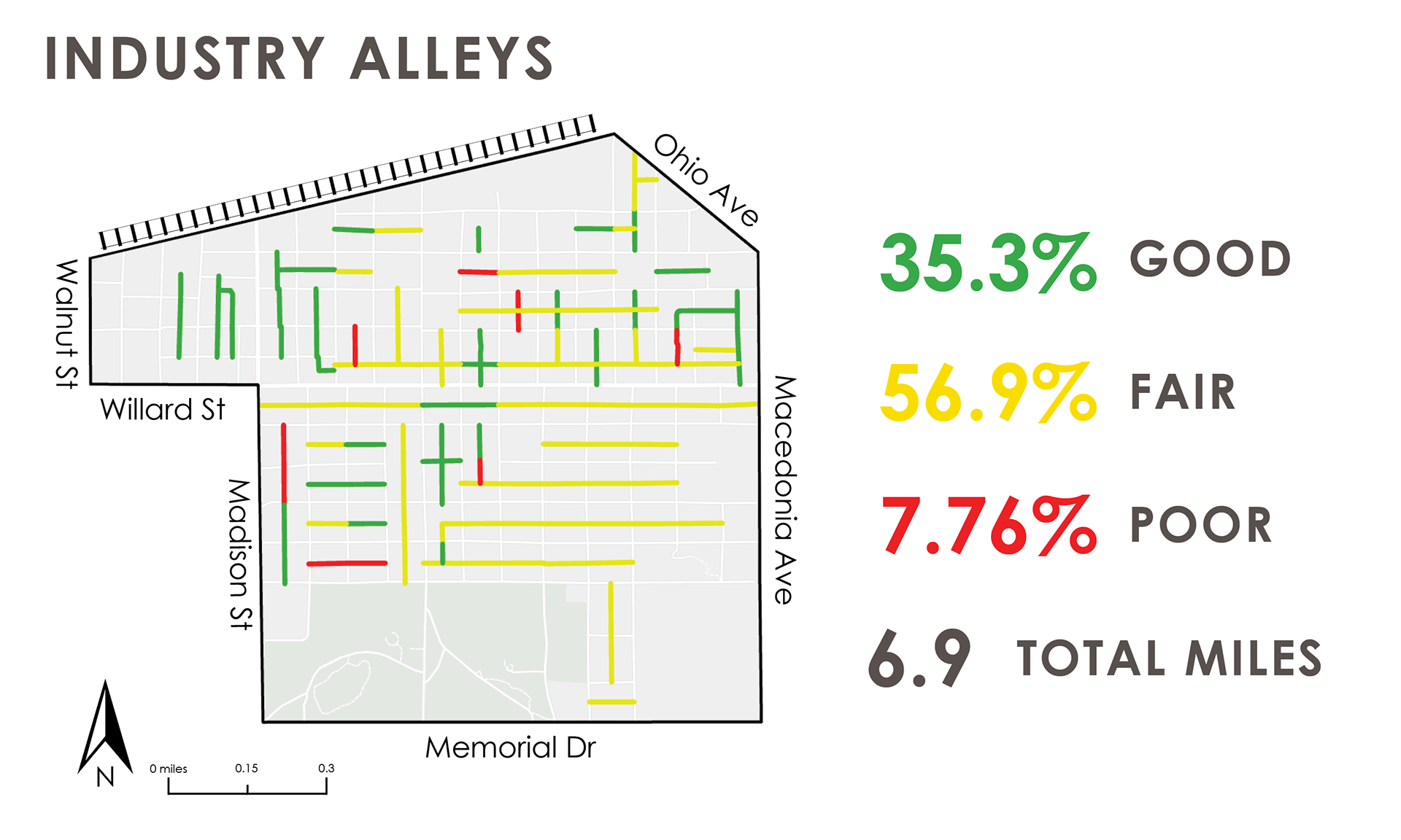
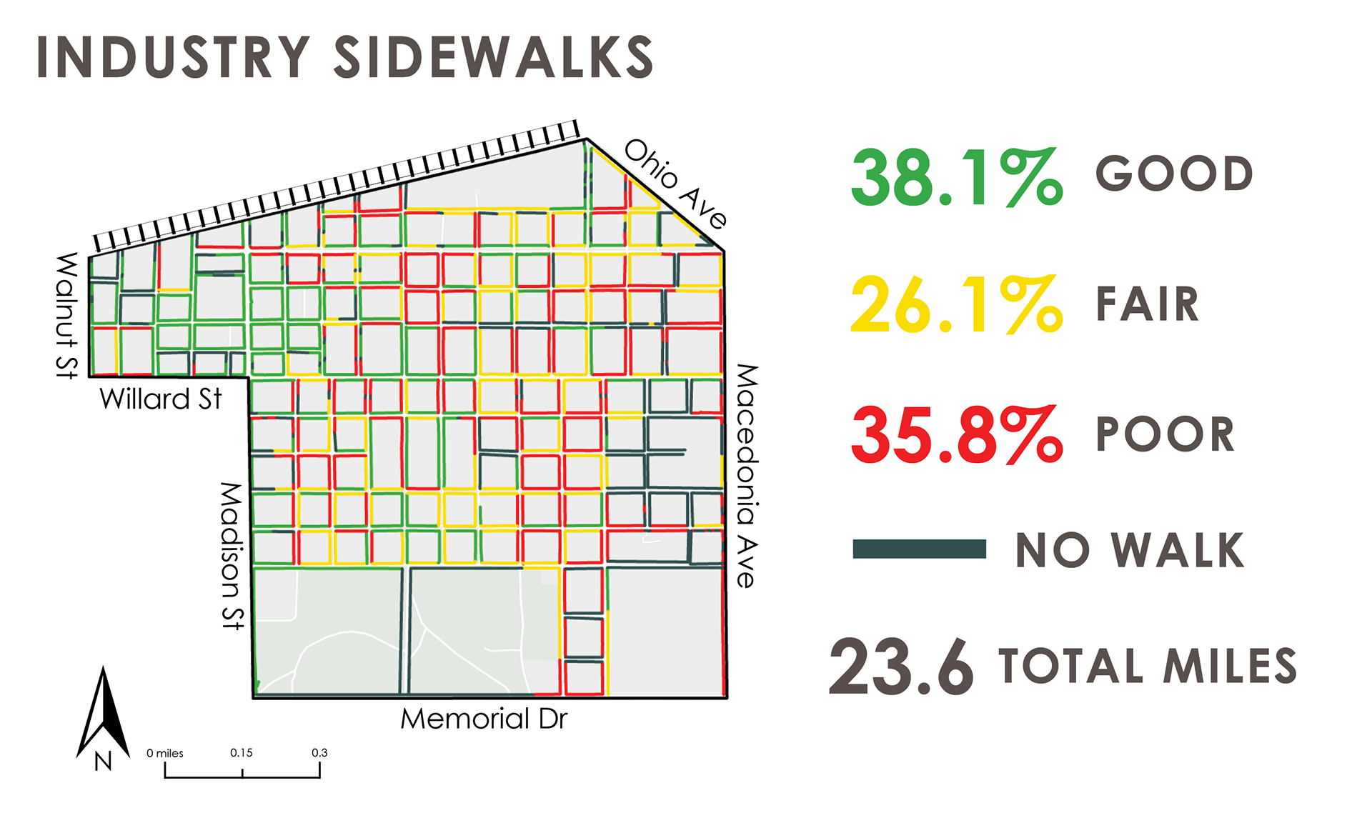
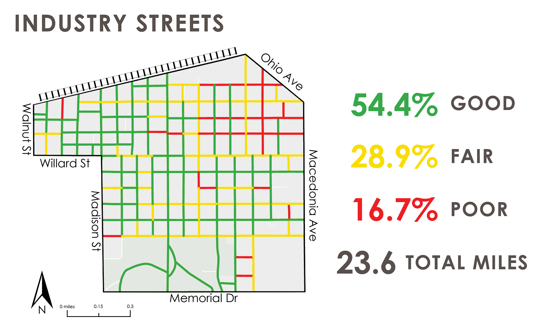
Infrastructure Mapping. ArcGIS Collector empowered studio teams to grade infrastructure quality while in the neighborhood from a scale of “Good” to “Poor”, with an added ability to attach field images to identified infrastructure issues.
Housing + Land Mapping. Along a similar metric, every house in Industry was identified as being “Good”, “Fair”, or “Poor” and reported in community presentations and final planning documentation.
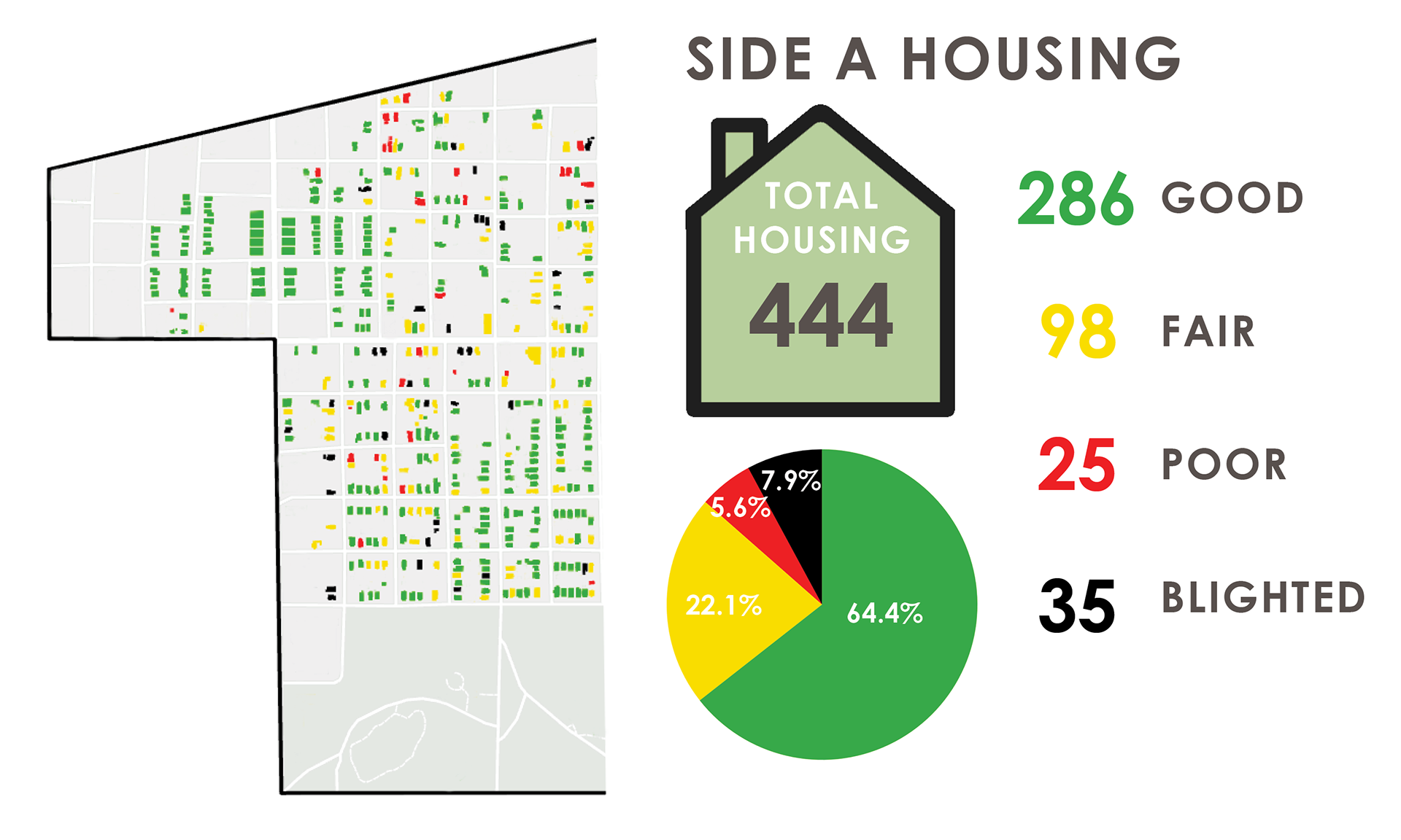

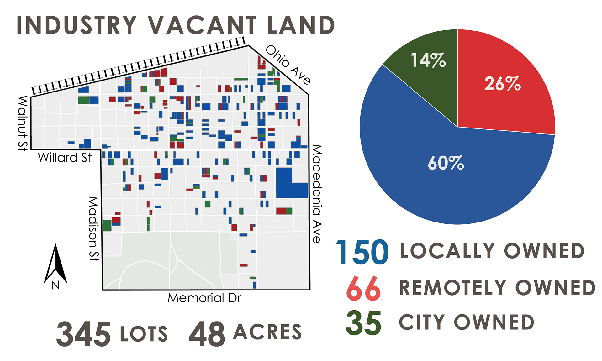
Presentation Graphics. For the benefit of community presentations and the final planning document, several map frames were generated using ArcGIS Pro.
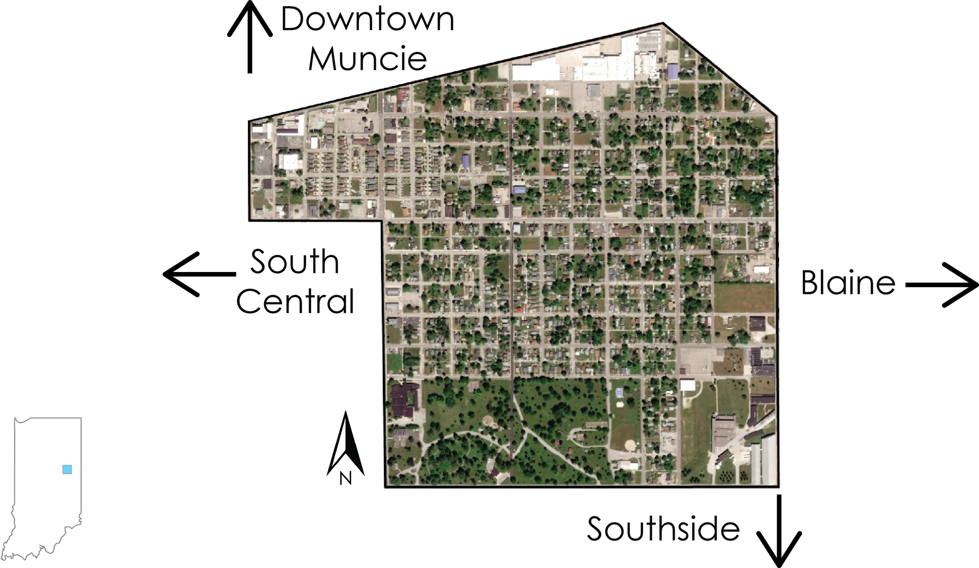
thumbnail map
