Project Background
As a transportation planning intern with the Village of Schaumburg, Illinois from May to August 2020, my position undertook regular monitoring of municipal and regional transportation networks. While the process involved labor-intensive field observation and data collection, I optimized department efficiency with ArcGIS Collector and Microsoft Excel to catalog infrastructure concerns and Dial-a-Ride ridership during COVID-19. Of this data, I was able to generate deliverable reports and maps regarding village-wide transportation patterns. This data was shared both in weekly department meetings and with engineering department officials to inform areas of concern for the 2021 capital improvement plan, while identifying services to temporarily suspend for the emergency balancing of the village’s budget.
As a transportation planning intern with the Village of Schaumburg, Illinois from May to August 2020, my position undertook regular monitoring of municipal and regional transportation networks. While the process involved labor-intensive field observation and data collection, I optimized department efficiency with ArcGIS Collector and Microsoft Excel to catalog infrastructure concerns and Dial-a-Ride ridership during COVID-19. Of this data, I was able to generate deliverable reports and maps regarding village-wide transportation patterns. This data was shared both in weekly department meetings and with engineering department officials to inform areas of concern for the 2021 capital improvement plan, while identifying services to temporarily suspend for the emergency balancing of the village’s budget.
Schaumburg Dial-a-Ride Ridership. Visualization of COVID-19’s effect on the Village’s Dial-a-Ride service.

Dial-a-Ride Pickup Points - Summer 2019 (pre-COVID)
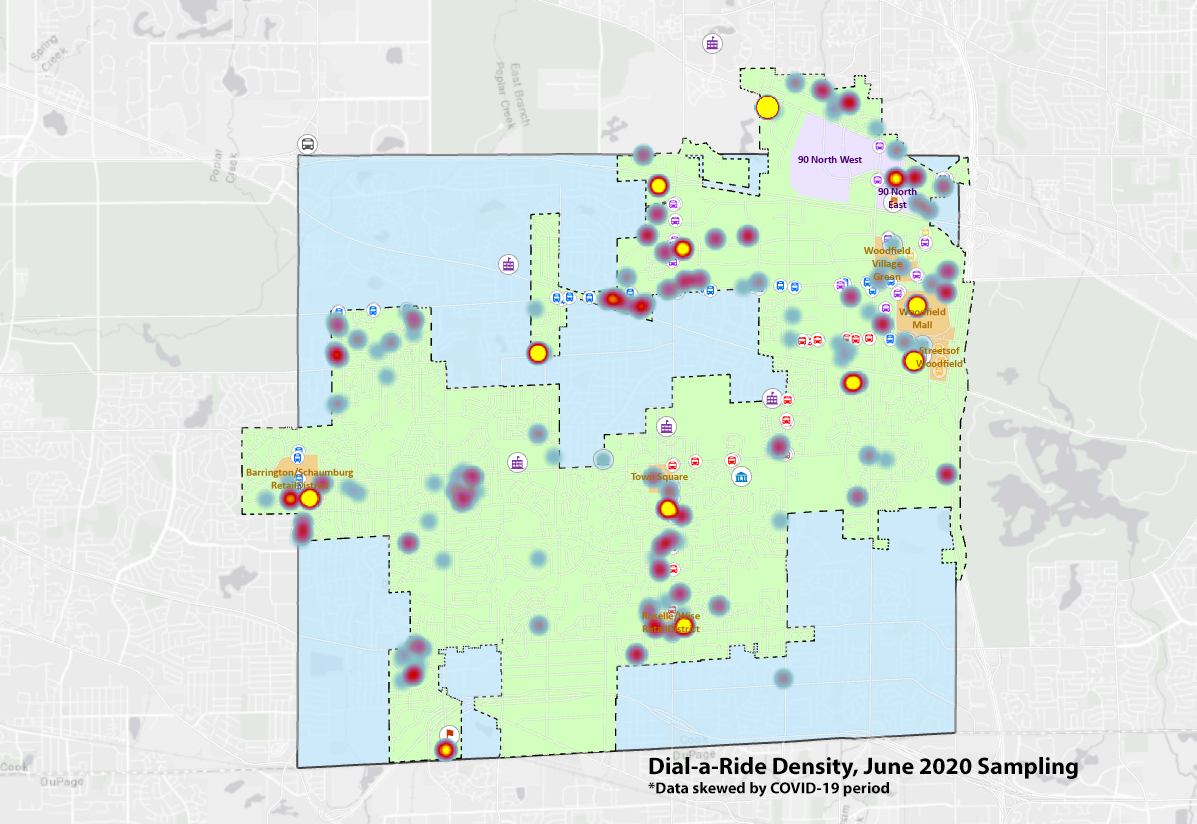
Dial-a-Ride Pickup Points - June 2020 (within-COVID)
Senior Taxi Ridership. Study of subsidized taxi pickup locations for adults 65+ and individuals with disabilities, assessing the demand for essential emergency and appointment travel.
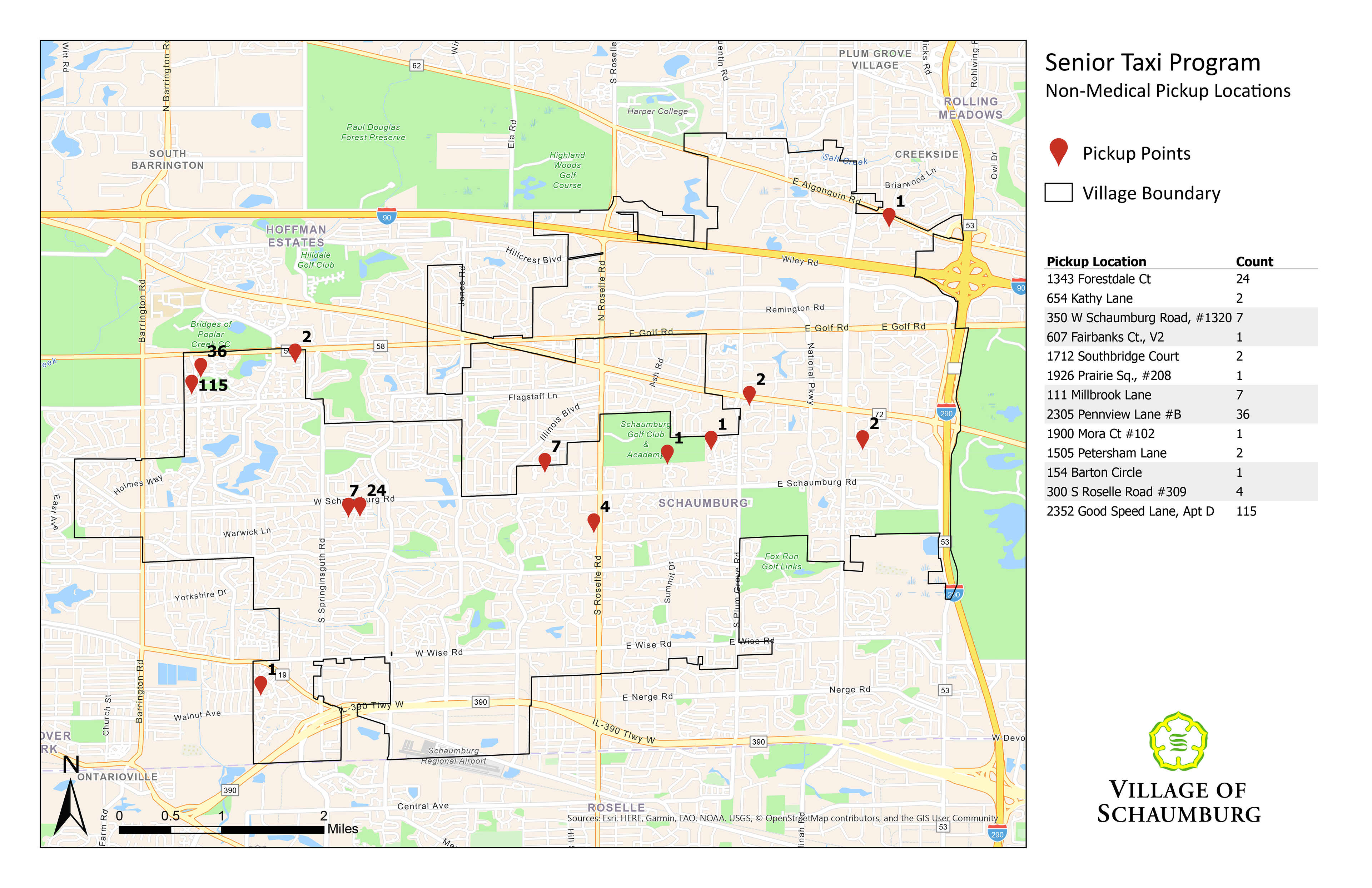
Non-Medical Pickup Locations
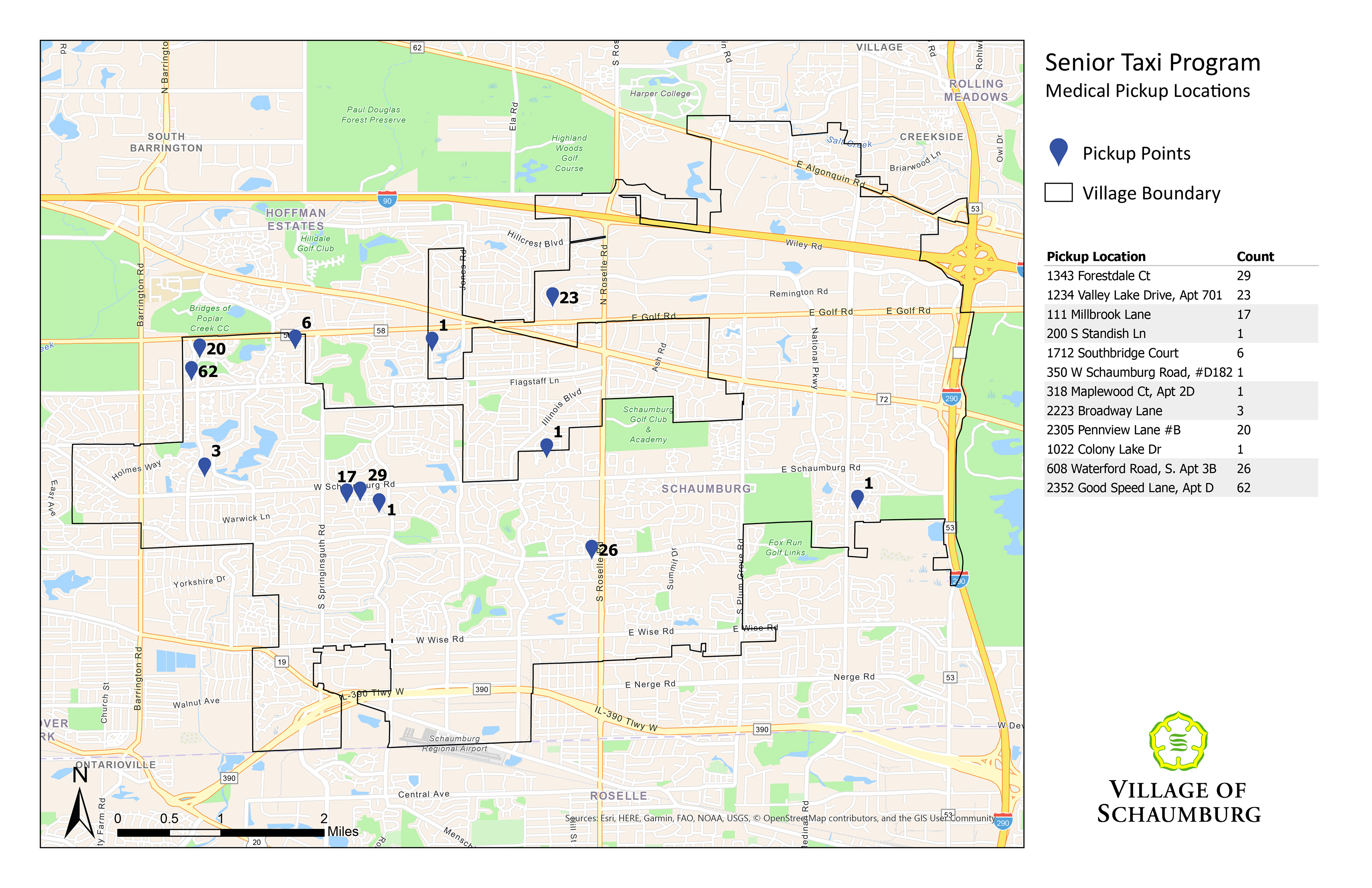
Medical Pickup Locations
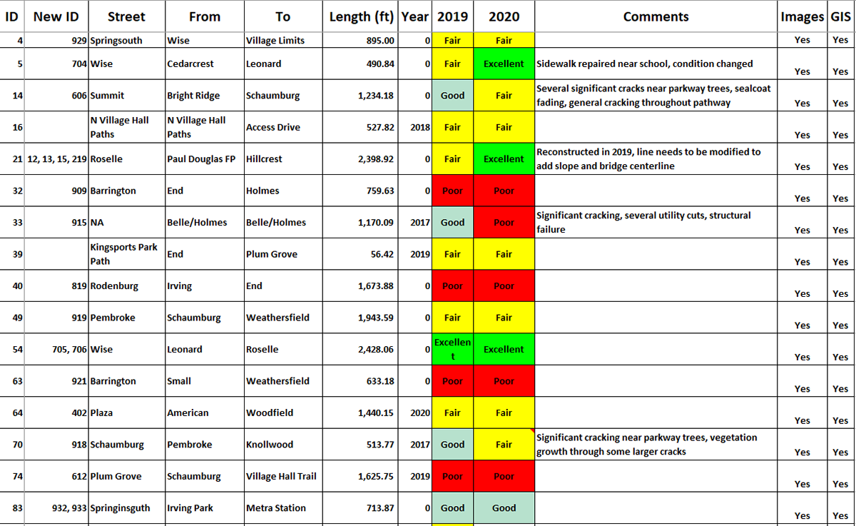
Bikeway Inventory. Field collection of bike path quality with images and GIS mapping.
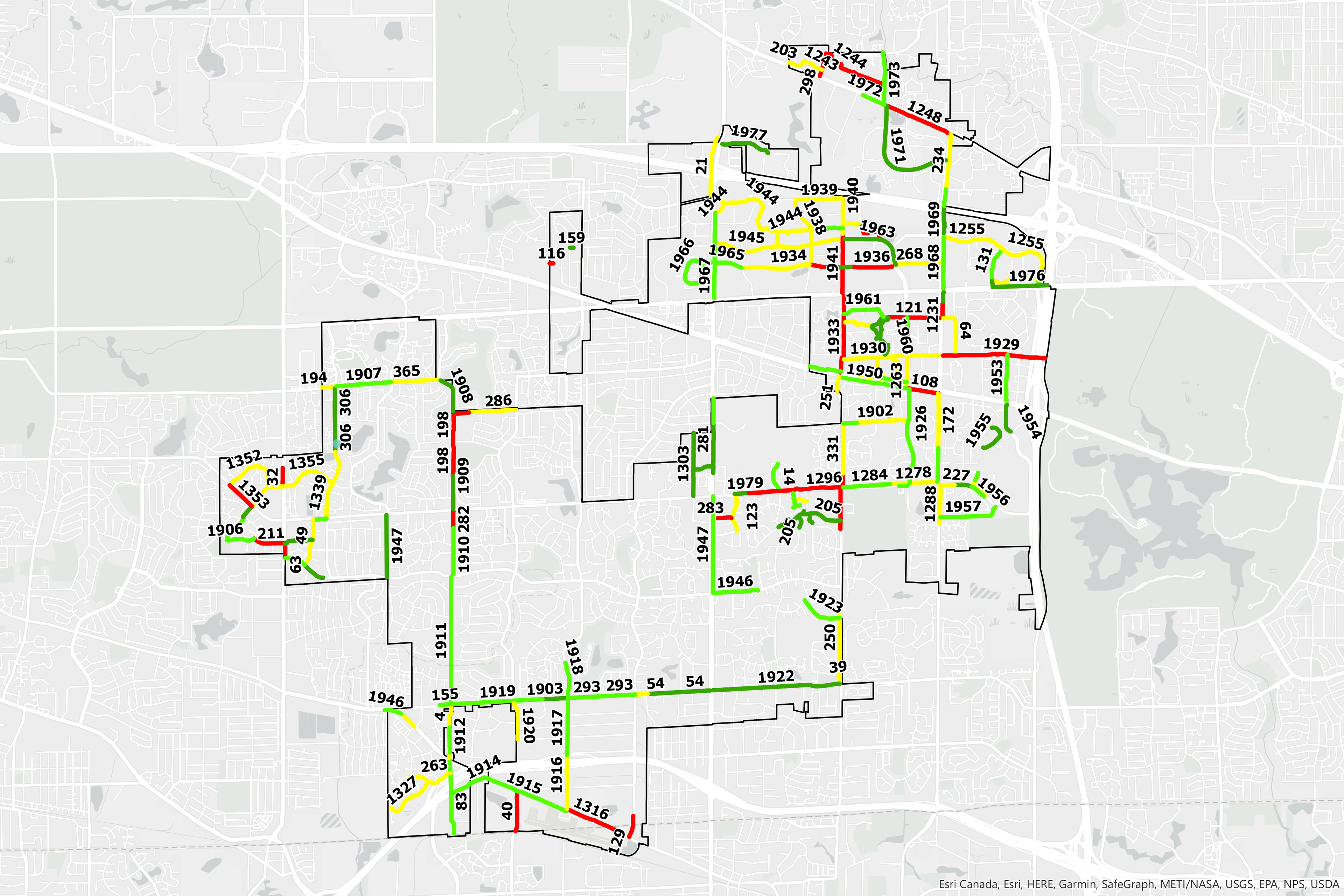
Field Assessment Map
